Learn NYC property · Zoning and land use
Zoning districts: R, C and M, overlays and special districts
How New York City's Zoning Resolution divides the city into residence, commercial and manufacturing districts, how to read a code like R7A or C4-5X, and what commercial overlays, special purpose districts, limited height districts and split lots add.
Zoning is the City law that says how land may be used and how much may be built on it — homes, shops, factories, open space — and what shape the buildings may take. In New York City that law is the Zoning Resolution, adopted in 1961; it has two parts, a set of maps that divide the city into districts and a text that holds each district's rules.
For anyone buying, owning or lending against a property, the zoning district is the first fact to check after the address. It decides whether a lot may hold apartments, offices or a warehouse, how big a new building may be, and whether an existing one could be enlarged. It is also why two similar buildings on either side of a street can be worth very different amounts.
Who makes and changes the zoning
The Department of City Planning (DCP) writes and maintains the Zoning Resolution and its maps; the City Planning Commission, which City Planning staffs, votes on every change before the City Council takes it up. The Department of Buildings enforces the zoning when it reviews plans and issues permits.
New York wrote the country's first comprehensive zoning law, the Building Zone Resolution adopted on July 25, 1916, which set height and setback rules and separated homes from industry. Today's Resolution was adopted by the Board of Estimate on December 15, 1960 and took effect on December 15, 1961. It introduced the three kinds of district that still organise the city, and has been amended many times since — most widely by the City of Yes amendments of 2023 and 2024. The map is 126 sheets on a grid of 35 numbered sections; DCP's online map, ZoLa, is a convenience, and the official maps control.
The three kinds of district
A lot's zoning district is the area of the zoning map it falls in, and its code says what is allowed there. The first letter is the kind: R for residence, C for commercial, M for manufacturing. Numbers follow, and sometimes a letter.
By BlockLot Intelligence's count of City Planning's lot file, 93.1% of the city's lots are in residence districts, and residence districts cover 72.4% of the zoned lot area outside parks — City Planning puts it at about three-quarters of the city's zoned land.
Every lot in City Planning's lot file by the district covering most of it. A condominium counts once. The paired districts, such as M1-4/R7X, allow homes and light industry side by side. BlockLot Intelligence, computed October 10, 2026.
Residence districts: R1 to R12
Residence districts allow homes and community facilities such as schools, houses of worship and hospitals. The number is density: R1 and R2 allow only detached houses, R3 and R4 one- and two-family houses and some small apartment buildings, R5 townhouses and small apartment buildings, and R6 to R10 apartment buildings of rising size, nearer the business districts and the subway. The City of Yes for Housing Opportunity amendment of December 5, 2024 added R11 and R12, the densest of all, which may be mapped only where Mandatory Inclusionary Housing applies; Midtown South's 2025 rezoning was the first to use them. A second number after a hyphen, as in R3-1 and R3-2, marks a variation in the rules within the same density.
Lots whose main district is a residence district, by its number — the higher the number, the more may be built. R3-2, R6A and R6B all count under their number. BlockLot Intelligence, computed October 10, 2026.
Low-density districts dominate the map: R3 and R4 alone hold 44.9% of all lots, the one- and two-family neighbourhoods of Queens, Staten Island, Brooklyn and the Bronx.
A letter at the end — A, B, D or X, as in R6A, R7B or R8X — marks a contextual district, which sets fixed limits on the height of a new building and on how far it sits from the street, so that it matches the buildings around it. Districts without a letter allow more freedom in shape, and at high densities towers. In the low-density districts the same letters mark different house types and lot rules rather than contextual apartment buildings, and in manufacturing districts an "A" marks the new kinds of district created in 2024.
Commercial districts: C1 to C8
Commercial districts allow shops, offices and services, and most also allow homes:
- C1 and C2 — local shops serving the blocks around them, most often mapped as overlays (below);
- C3 — waterfront recreation, such as boating, near low-density neighbourhoods;
- C4 — regional shopping centres outside the central business districts, such as Fordham Road or downtown Flushing;
- C5 and C6 — the central business districts of Manhattan, Downtown Brooklyn and Jamaica, with commercial floor area ratios up to 15;
- C7 — since 2024, job-intensive districts with no housing;
- C8 — heavy commercial uses such as car repair, warehouses and gas stations, with no housing.
The Zoning Resolution gives most commercial districts a residential equivalent that sets the rules for any housing built there: C4-2 and C4-3 follow R6, C4-5X follows R7X, and the C5 districts follow R10 or its contextual version, R10A. C7 and C8 have none, because they allow no homes.
Manufacturing districts: M1 to M3
Manufacturing districts allow industry and most commercial uses, and generally not housing. M1 is light industry — woodworking, repair shops, storage, offices — often a buffer between homes and heavier uses; M2 is middle ground, mostly older waterfront areas; M3 is heavy industry such as power plants and waste transfer stations. The numbers name the "performance standards" each must meet — limits on noise, vibration, smoke and odour — which are strictest in M1. City Planning counts about 28,500 acres zoned for manufacturing, some 15% of the city's land.
Overlays and other layers
A district can carry more than one layer of rules.
- A commercial overlay — C1-1 to C1-5 and C2-1 to C2-5 — is a strip of local retail mapped over a residence district, usually along an avenue: the corner grocery, the dry cleaner, the restaurant under apartments. Shops in an overlay are limited to one or two floors, below the homes. Unless the map says otherwise an overlay reaches 100 to 200 feet back from the street, depending on its type.
- A mixed-use district pairs a light-manufacturing district with a residence district — written like M1-4/R7X — so homes and workshops can share a neighbourhood. It is a special purpose district (MX), first mapped in 1997 in Port Morris.
- A limited height district — LH-1 (50 feet), LH-1A (60 feet), and LH-2 and LH-3, which are not mapped anywhere — caps building height inside some historic districts, such as Gramercy Park, Brooklyn Heights, Cobble Hill and the Upper East Side.
- An E-designation is a note on a lot, made when it was rezoned, that hazardous materials, noise or air quality must be dealt with before a new building or certain changes of use. The Mayor's Office of Environmental Remediation must sign off before the Department of Buildings issues the permit.
By BlockLot Intelligence's count of City Planning's lot file, 74,099 lots — 8.6% of the city's — carry a commercial overlay, 5,993 lie in paired mixed-use districts, 3,046 in limited height districts, and 10,936 carry an E-designation.
Special purpose districts
A special purpose district is a set of rules drawn for one area — to protect its character, steer growth or achieve a planning goal — that supplements or replaces the underlying district's rules. City Planning has created them since 1969; its 2025 Zoning Handbook counts 59, and rezonings keep adding more.
Examples are the Special Midtown District, shown as MiD (1982), Lower Manhattan (1998), Hudson Yards (2005), Clinton (1974) and Midtown South (2025). A lot in a special district must be read against that district's own chapter of the Resolution.
City Planning's lot file names a special district on 108,253 lots, under 94 codes, because sub-districts such as MX-1 have codes of their own.
Lots in two districts
A district boundary can cross a lot. A split lot is a lot lying in two or more districts; generally each part follows the rules of its own district. For a lot that existed before the boundary was drawn, the "25-foot rule" lets the district covering more than half of it govern the whole lot when the smaller part reaches no more than 25 feet beyond the boundary, and the floor area allowed on the lot is the average of the districts' allowances, weighted by area.
City Planning's lot file flags 20,005 tax lots as split between districts, overlays or special districts — counting only parts that cover at least a tenth of the lot.
Buildings that do not fit their zoning
Much of the city was built before 1961, so many buildings break today's rules, lawfully. The Zoning Resolution has a word for each case.
- A non-conforming use is a lawful use the district no longer allows — a corner store in a residence district, homes in a manufacturing district. It may continue, but if it stops for two years in a row only a conforming use may replace it; empty ground-floor stores in apartment buildings are an exception.
- A non-complying building is a lawful building whose size or shape breaks today's bulk rules — too tall, or with more floor area than the district now allows. It may stay and be altered, as long as nothing makes it less compliant; if 75% or more of it is destroyed, it must be rebuilt to today's rules, with more lenient treatment for one- and two-family houses.
BlockLot's "likely non-conforming" chip marks a lot built above the allowance that governs it. It is a flag to check, and in zoning's terms it more often means a non-complying building than a non-conforming use.
How zoning changes
A change to the zoning map — a rezoning — goes through the Uniform Land Use Review Procedure (ULURP), set by the City Charter. Once City Planning certifies an application complete, the community board has 60 days to give its advice, the borough president 30 days, the City Planning Commission 60 days to hold a hearing and vote, and the City Council 50 days to approve, change or reject it; DCP puts the whole review at about seven months. Changes to the text follow a similar review. Anyone may apply — the City, a property owner, a developer — and the larger changes need an environmental review first. Since a Charter vote in November 2025, some smaller changes and affordable-housing projects can take faster routes.
A worked example: the Empire State Building
The Empire State Building's lot is zoned C5-3, a central commercial district, inside the Special Midtown District (MiD). Its commercial floor area ratio is 15.0, the residential equivalent R10 allows 10.0 for standard housing, and community facilities may also reach 15.0. Built in 1931, three decades before today's Resolution, the tower holds about 2.1 times the commercial floor area its district now allows — a non-complying building, lawful because it came first. The floor area guide works through the numbers.
Where you see this in BlockLot
A building's page names its zoning district in the Zoning & use card — click the code for what it means and the other districts in its family — beside the land use and the floor area ratios. A block's page counts its lots by district and lists the overlays, special districts, limited height districts and split lots in its Development potential card.
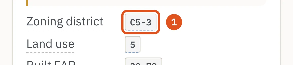
- the lot's district

- lots per district
Questions people ask
What does R6 mean? A medium-density residence district, where apartment buildings are allowed. R is residence and 6 is the density, on a ladder from R1, detached houses, to R12; an A, B, D or X after the number makes it a contextual district with fixed height limits.
Can I open a business in a residential zone? Only where the zoning allows it. Shops are allowed in a residence district where a commercial overlay is mapped, and some home occupations are allowed in homes; otherwise a business needs a commercial or manufacturing district.
How do I find out how a lot is zoned? City Planning's ZoLa map shows the district for any lot, and the official zoning maps decide. BlockLot shows it on every building's page.
What is the difference between zoning and land use? Land use is what is on the lot today; zoning is what the law allows there. A lot zoned for apartments can hold a one-family house, and an older building can hold a use its district no longer allows.
Can zoning change? Yes, through a rezoning or a text amendment, after public review that ends with votes by the City Planning Commission and the City Council. Buildings that stood before a change may stay, as non-conforming uses or non-complying buildings.
What is a special district? An area with its own chapter of zoning rules that adds to or replaces the underlying district's — the Special Midtown District is one. A lot in a special district must be read against that chapter as well.
Related
- Floor area ratio (FAR): built, residential, commercial and community facility — What a floor area ratio is, how zoning sets one for homes, businesses and community facilities, which one governs a building, what City of Yes changed, and why some older buildings stand far above their district's allowance.
- City of Yes and Mandatory Inclusionary Housing: the zoning changes of 2023 to 2024 — What the three City of Yes zoning amendments changed — carbon neutrality, economic opportunity and housing opportunity — with the Universal Affordability Preference, parking, accessory units and conversions, and how Mandatory Inclusionary Housing requires affordable homes in rezoned areas.
- Air rights, unused floor area and zoning lot mergers — What New York City's air rights are, how unused floor area moves to a neighbouring lot through a zoning lot merger or further through a transfer of development rights, how the deals are recorded, and what BlockLot means by a soft site and an assemblage candidate.
- Landmarks and historic districts: what designation by the Landmarks Preservation Commission means — How New York City designates individual, interior and scenic landmarks and historic districts, what an owner must do afterwards — permits, upkeep, fines — and how a landmark can sell its unused floor area.
- Building class codes and land use: what A1, C6, D4, O4 and R4 mean — How the Department of Finance's two-character building class describes every property in New York City, the 25 letter families from A to Z, the codes beginners meet most, how a building class relates to the tax class, and City Planning's eleven land-use categories built from it.
- Lot size, frontage and depth: corner lots, through lots, irregular lots and wide streets — How New York City measures a lot — its area, frontage and depth — what makes a lot a corner, through or interior lot, why irregular lots and wide streets matter under zoning, and what the minimum lot sizes became after City of Yes.
- Flood zones and hurricane evacuation zones: FEMA's maps, NYC's projections and Know Your Zone — What a FEMA flood zone (VE, AE, A, X) and a base flood elevation mean for a New York City property, why the City uses both FEMA's 2007 map and its 2015 preliminary map, what the projected floodplains show, and how the six hurricane evacuation zones differ from all of them.
Sources
- BlockLot Intelligence — BlockLot's own analysis of the public records below, computed October 11, 2026.
- DCP — Zoning in New York City (history, amendments)
- DCP — Residence districts (R1 to R12)
- DCP — Commercial districts
- DCP — Manufacturing districts
- DCP — Special purpose districts
- DCP — NYC Zoning Handbook, 2025 edition
- DCP — NYC Industrial Plan, update 1 (April 2025)
- DCP — Public review (ULURP)
- Zoning Resolution 11-121 (district names)
- Zoning Resolution 11-122 (districts established)
- Zoning Resolution 11-123 (special purpose districts)
- Zoning Resolution 11-15 (E-designations)
- Zoning Resolution 12-10 (definitions)
- Zoning Resolution 34-112 (residential equivalents of commercial districts)
- Zoning Resolution 76-131 (depth of commercial overlays)
- Zoning Resolution, Article VII Chapter 7 (lots in two or more districts)
- Zoning Resolution 23-443 (limited height districts)
- Zoning Resolution 123-10 (Special Mixed Use District)
- Zoning Resolution, Article V (non-conforming uses and non-complying buildings)
- Zoning Resolution, Appendix B (index of special purpose districts)
- Mayor's Office of Environmental Remediation — E-designations
- DCP — PLUTO Data Dictionary, August 2026 (26v2)
- NYC Open Data — PLUTO